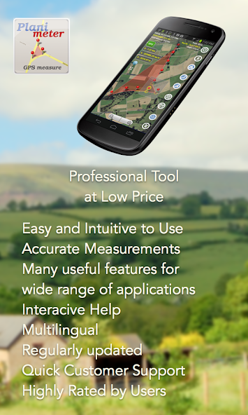
Leading tool for land survey, fields area measure, perimeter, distance with GPS
Planimeter is the best land surveying app and field area measurement tool.
With the free version, you can start measuring right away by simply touching the map. But for a comprehensive toolkit, unlock all features with a subscription.
Unlock features like:
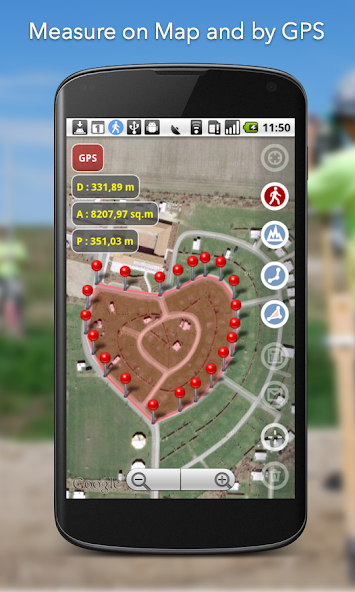
- measure distance, perimeter, bearing, angle, and GPS coordinates in various formats directly on the map.
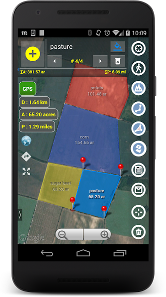
- save, edit, label, view, and share your measurements as KML data files and screenshots.
- live measurement using GPS tracking (walk/drive around) with time interval and accuracy settings;
- achieve pinpoint precision with a magnifying glass for accurate pin placement: https://youtu.be/Hha_nmC032M
- add points with exact distance and angle input for precise measurements. (Distance and Bearing Feature): http://goo.gl/8XbhJU
Other exclusive features include:
- creating, sharing, and viewing KML files: http://goo.gl/2cdI8w
- Intuitive label addition in Notes Mode: http://goo.gl/s52VdU
- quick access to directions and navigation from Notes Mode: http://goo.gl/nCRTQi
- smart tools for removing redundant points and generating convex areas.
- support for various geo-coordinate formats
- quick switch and view measured paths and polygons in the Google Earth app
- multiple areas measurements: https://goo.gl/SrFMj3
- circle Mode - radius around point: https://goo.gl/dkHuvy
- volume/cost calculator when height or rate per area unit entered https://goo.gl/dkHuvy
Languages: English, Portuguese, Russian, German, Italian
Join thousands of satisfied users who've applied Planimeter in diverse scenarios:
- outdoor activities: golf (distance between two points or holes), bike and hike trail planning, quick path measure or mapping a run
- garden and yard: landscape planning, grass cutting, lawn care and mowing, fencing, grass seeding.
- agriculture and farming: harvesting, fertilizing, crop planning, and estimation, field labeling, field area measure, paddocks, and area fencing,
- solar energy: solar panels placement estimation, flat roof area estimation
- construction: land and site survey, road sealing, parking lot repair, pole lines planning
- forestry: objects and tree mapping, damage area estimation, measuring land area
- insurance: crop adjuster tool, verify data and support claims
- property: check location context by measuring distances to nearby schools, parks, police stations, and shopping centers.
- other: fence calculation, geocaching, quick estimation, and quotes for land-related work
More about the app, tips, and updates: https://vistechprojects.blogspot.com/search/label/Planimeter
Get free Primogems, Mora, Experience, and more with these November 2024 Genshin Impact codes, 5.1 livestream codes, and find out how to redeem active codes.
If you are bored with playing the vanilla version of Metaphor ReFantazio, you can check out these five mods.
Struggling with your submissions for Roblox's The Haunt event in 2024? Check out our guide on using Dress to Impress to create your captures!
Our walkthrough for Dragon Age: The Veilguard with some handy tips and tricks, with guides for puzzles, bosses, companions, equipment, romance, and more!
Which faction should you pick in Dragon Age: The Veilguard?
Looking for some bonus resources in Sea of Conquest: Pirate War? We’ve got you covered with these codes for the latest seafaring freebies.
On our website, you can easily download the latest version of Planimeter - GPS area measure! No registration and SMS required!